Category: Space

  • NAMA, NIGCOMSAT Collaborate to broaden Satellite-Based Navigation System

    NAMA, NIGCOMSAT Collaborate to broaden Satellite-Based Navigation System

    The Nigerian Airspace Management Agency (NAMA) is set to collaborate with the Nigerian Communications Satellite Limited (NIGCOMSAT) to broaden its satellite-based navigation system called the Satellite Based Augmentation System (SBAS).

    This expansion will transcend Nigeria’s airspace to the airspace across the African continent, which will result in improved precise landing and take-off for pilots.

    The Acting Managing Director of NAMA, Matthew Pwajok, announced this during the SBAS flight demonstration at the Nnamdi Azikiwe International Airport, Abuja.

    According to Pwajok, the expansion is to better improve safety in Nigeria’s airspace, save funds for airlines and provide specific guidance to pilots.

    He further explained that it would use equipment not based on the ground to guide flights but based on satellite systems to navigate, which is akin to what NAMA had installed years ago, which is the Performance Based Navigation (PBN)..

    Read also: South African Dragonfly Aerospace startup, Launches microsatellite EOS SAT-1

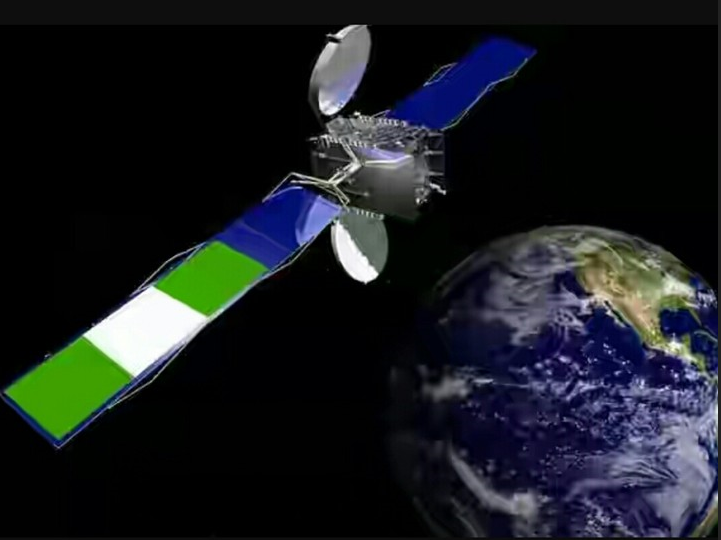
    The Satellite Based Augmentation System (SBAS) coverage

    Pwajok affirmed that the NIGCOMSAT satellite would cover broader airspace, from Nigeria to other regional airspaces that could serve the African region and beyond.

    “Some years ago, Nigeria implemented what we call Performance Based Navigation, which is a satellite system for navigation and what it does is to use a satellite-based system with an aircraft equipped with a performance system to navigate or to fly.

    The NAMA Director explained that the SBAS would aid pilots in using satellite systems to steer their aircraft in the airspace.

    According to him, “when the aircraft uses that with ground procedures that are developed with flight procedure design, it enables it to manoeuvre, approach and land.

    “It can also be used for en-route whereby you provide air routes so that after take-off, it follows what we call a standard aircraft departure that is based on satellite. That is using a satellite to develop manoeuvres for an aircraft for take-off to climb to the en-route phase.

    He added that “when it reaches the en-route phase, when you have an air route based on satellite it continues with the same satellite system to also fly from one point to the other. So the satellite-based navigation system covers all phases of flight.”

    He further stated that performance-based navigation gives lateral guidance to pilots and increases the signal’s accuracy, integrity, availability, and continuity.

    “…what is now required is to put a ground infrastructure, a monitoring system, a control system or a master station that receives signals from several satellites, triangulate them and take the best location or find a space induction or signal and now broadcast it through a broadcast media worldwide or globally and it will be reviewed by any aircraft that is flying within that vicinity and use it now for more precision.

     “So, we have done performance-based navigation that provides general lateral guidance for pilots to locate airports. We now want to improve on it to do what we call precision approaches,” Pwajok also explained.

    He revealed that the system has been used in the United States and other areas of the world and that Nigeria had accepted the system through NAMA performance-based navigation, but the system now wants to be expanded in partnership with NIGCOMSAT.

    NAMA’s Partners with Airspace Management

    NAMA is collaborating with the Agency for Aerial Navigation Safety in Africa and Madagascar (ASECNA) to provide airspace management services to French-speaking countries in West Africa and beyond, including 16.1 million square kilometres of airspace covering six Flight Information Regions – Antananarivo, Brazzaville, Dakar Oceanic and Terrestrial, Niamey, and N’Djamena.

    “Our sister agencies from ASECNA states are also here. Europe is here, America is here and so on. In collaboration with the International Civil Aviation Organisation (ICAO), we are all going to monitor and see.

    Pwajok explained that when it is visible that the signal has been transmitted, received, augmented and re-transmitted, it can guide aircraft precisely, an improved accuracy, an improved landing, approved takeoff and climb, then we will be able to now say yes, we can work towards implementation like the rest of the world. So the satellite-based navigation system is a very important milestone.”

  • South African Dragonfly Aerospace startup, Launches microsatellite EOS SAT-1

    South African Dragonfly Aerospace startup, Launches microsatellite EOS SAT-1

    Dragonfly Aerospace, a start-up company in South Africa’s aerospace industry, has generated a lot of buzz as its microsatellite, which was made in South Africa, launches from Cape Canaveral. As a component of the Transporter-6 mission, the EOS SAT-1 satellite was launched from the SpaceX launch site.

    The live launch was supposed to take place at 09:56 Eastern Time (ET) or 14:56 Greenwich Mean Time (GMT) on Tuesday, 3 January 2023; nevertheless, it took place at 17:00 UTC/18:00 GMT on Thursday, 5 January 2023.

    According to its co-founder and chief executive Bryan Dean, the company is very excited about the launch of SpaceX’s Transporter-6. Dragonfly Aerospace, which has its headquarters in Stellenbosch, is now working on the construction of a network of compound “eyes in the sky” that promises to be revolutionary for both industries and society.

    Read also: Egypt Plans Satellite To Monitor Climate Change In Africa

    CEO’s Remark Before EOS SAT-1

    Dean had this to say before the launch, “This is a key moment for Dragonfly Aerospace and we are thrilled to be delivering EOS SAT-1 with a number of firsts – the first imaging satellite designed and built by Dragonfly, the first microsatellite to be manufactured in South Africa since 2009, the first satellite of the EOS SAT constellation and the first agri-focused constellation in space.”

    “This has been an important project for our whole team and has allowed us to demonstrate our capabilities, not just in producing high-performance electro-optical imagers, but in designing and manufacturing a full imaging satellite system.”

    Dean adds that the Dragonfly Aerospace team is excited about the opportunity to assist EOS Data Analytics (EOSDA) in achieving its goal of launching the subsequent six satellites by the year 2025. For client EOSDA, this satellite is the first of a constellation of seven satellites that will be placed in low Earth orbit.

    Egypt aided by AfDev-Sat Plans To Deploy First Satellite Prototype For Climate Monitoring

    Details on EOS SAT

    EOS SAT is the world’s first satellite constellation with a primary emphasis on agriculture. Its mission is to provide the agricultural and forestry industries with high-quality data in order to promote techniques that are both efficient and environmentally friendly.

    The images that Dragonfly’s EOS SAT-1 gathers will provide vital information that can be used for harvest monitoring, application mapping, seasonal planning, and evaluations that describe such as soil moisture, yield prediction, and biomass levels.

    This kind of knowledge will have significant positive effects on the ecosystem of our planet, and it will assist in preventing the depletion of natural habitats that are necessary for the development of crops and the preservation of biodiversity.

    EOS SAT-1 is one of the most competent imaging satellites currently operating in LEO since it is fitted with two DragonEye electro-optical imagers. These images will allow the satellite to capture panchromatic and multispectral pictures over 11 spectral bands at a resolution of almost 1 metre.

    Dr Max Polyakov, a prominent worldwide businessman, investor, and economist, made the announcement in April 2021 that he had successfully completed the purchase of a controlling share in Dragonfly Aerospace. A group of five satellite engineers led by Dean, a worldwide expert in microsatellites and high-resolution cameras, established the new company. Dean is also the company’s president.

  • University of Delft unveils more accurate positioning system than GPS

    University of Delft unveils more accurate positioning system than GPS

    An announcement has been announced that a new positioning system has been invented that is said to be more accurate and reliable than GPS, especially in urban areas.

    Researchers from Delft University of Technology, Vrije Universiteit Amsterdam, and VSL collaborated on the prototype. Their efforts resulted in a location accuracy of 10 centimetres.

    The newly developed technology may be useful in developing a wide variety of location-based applications, such as automatic vehicles, quantum communication, and the next generation of mobile communication systems.

    The Global Positioning System (GPS) of the United States and the Galileo system of the European Union are both examples of global navigation satellite systems. When we rely on satellites, we accept both their capabilities and the risks associated with those capabilities. When received on Earth, their radio signals are quite faint, and accurate placement is no longer achievable if the radio signals are reflected off of structures or if they are blocked entirely by buildings.

    Christiaan Tiberius, the project coordinator at Delft University of Technology, stated that “this can make GPS unreliable in urban environments, for instance,” which is a concern if we ever wish to deploy driverless vehicles. A large number of applications and navigational devices, including those used by residents and our authorities, are genuinely dependent on GPS. In addition to that, we did not have a backup mechanism up to this point.

    Read also: Egypt aided by AfDev-Sat Plans To Deploy First Satellite Prototype For Climate Monitoring

    Super GPS

    The new ‘SuperGPS’ project’s objective was to create an alternative positioning system that uses the mobile telecommunication network rather than satellites and has the potential to be more reliable and accurate than GPS. This system was to be developed in order to fulfil this objective.

    Jeroen Koelemeij of Vrije Universiteit Amsterdam stated, “we realized that with a few cutting-edge innovations, the telecommunication network could be transformed into a very accurate alternative positioning system independent of GPS.” “We realized that with a few cutting-edge innovations, the telecommunication network could be transformed into a very accurate alternative positioning system.”

    “We have been successful in our efforts to design a system that can give connectivity in the same way that existing mobile and Wi-Fi networks do, as well as accurate positioning and time distribution in the same way that GPS does,”

    Connecting the mobile network to an extremely precise atomic clock is one of these innovations. This will allow the mobile network to broadcast perfectly timed messages for positioning, similar to the way that GPS satellites do with the assistance of the atomic clocks that they carry on board.

    These connections are established by utilizing the already established fiber-optic network. Erik Dierikx of VSL said, “We had already been looking into ways for our atomic clocks to send the national time to users in other places through the telecommunications network.” “We had already been investigating techniques to distribute the national time produced by our atomic clocks to users elsewhere.”

    “Via these methods, we are able to transform the network into a nationally distributed atomic clock, which opens the door to a broad variety of new applications, including highly precise positioning using mobile networks.” We have now shown that a hybrid optical-wireless system works. This means that, in theory, anyone can use a wireless connection to get the national time from VSL. This was accomplished through the use of the system that we have now. In essence, it creates a radio clock that is incredibly precise and precise to the one-billionth of a second level.

    SpaceX and T-Mobile to provide satellite connectivity for smartphones

    More on the GPS

    The system uses radio signals with a bandwidth that is much wider than what is usually used.

    Radio waves can be bounced off of buildings, which can make navigational aids less accurate. According to Gerard Janssen of Delft University of Technology, “the huge bandwidth of our system helps sort out these misleading signal reflections and therefore permits improved location precision.”

    “At the same time, there is a limited amount of bandwidth available inside the radio spectrum, which makes it pricey.” To get around this problem, many radio signals with narrow bandwidths linked together and spread out over a wide virtual bandwidth are used. Because of this, only a small portion of the virtual bandwidth is actually used, and the signals can be very similar to those of mobile phones. This has the advantage of saving resources.

  • VUZ raises $20M to launch its social app

    VUZ raises $20M to launch its social app

    VUZ, a social app, has recently raised $20 million in Series B funding. The app enables users to stream and experience immersive realism in extended reality and metaverse digital experiences. Some of the investors in this round of funding include DFDF (Dubai Future District Fund), WIN (Webit Investment Network), SRMG, Elbert Capital, Yasta Partners, Faith Capital, and Panthera Capital. 

    Additionally, seven current investors took part in the offering. Web3 products have claimed 1 billion screen views from 10 million users since their introduction. 44% came from the Middle East, 32% from the U.S., and 24% from Egypt. VUZ wants 3 billion views by 2023 and to quadruple its user base annually. Immersive creative partnerships power the content on VUZ, where top artists’ videos have been seen over 100 million times around the world.

    VUZ, whose headquarters are in Dubai, says that this round, in which it has brought in investors from the US, Europe, the Middle East, and Africa, will be very important for the company’s plans to grow internationally. 

    Read also: The Rebooked app helps SA students optimize textbooks

    Khaled Zaatarah, founder and chief executive officer of VUZ, founded the platform under its previous name, 360VUZ, with the intention of bridging the gap between the real and virtual worlds by providing quality immersive content to an audience all over the globe. Zaatarah said VUZ’s mission is to connect people by giving “genuine, engaging experiences.”.

    The platform delivers over 20,000 hours of entertainment, creative, sports, XR, VR, and AR content worldwide. Users may attend live events, concerts, celebrity interviews, and masterclasses using VUZ’s iOS and Android applications. 70% of VUZ’s material is free and monetized by commercials; consumers must pay $4–8 for exclusive content. The company wants to give people access to content through Meta headsets, Qualcomm, immersive avatars, and a web platform.

    How will VUZ use the money?

    The money will be utilized to improve monthly recurring revenue growth by 10%, invest in content, employ senior hires, launch web3 products and NFT initiatives, and scale asset-light into 8 new foreign markets. VUZ will also expand its Los Angeles office and work with creators in the U.S., Asia, and Europe. The CEO said the company’s future ambitions are 10 times greater than those of the last 6 years. “We’re equipped for sustained scalability and growth at a scale-up stage,” Zaatarah says.

    The telecommunications industry is placing its bets on immersive media because they believe it will be one of the most successful use cases for 5G and will shape the future of video streaming. Zaatarah has said that the company’s worldwide development is supported by the collaboration and integration it has achieved with 45 different cellular carriers. 

    MTN Becomes Africa’s First Metaverse Landlord, Buys 144 Plots of Virtual Land

    Even Dan Caruso, the managing director of Caruso Ventures, said that his organization invested in the company because it is ideally positioned to establish a global platform and work with the leading telecom providers worldwide. One of these partners is e&, a UAE-based telecom company that just changed its name. Last week, e & capital, the company’s venture capital arm, announced a $250 million fund.

    VUZ is one of e&C’s first MENA investments, having raised over $30 million. The immersive media platform will use telecom operators’ infrastructure to grow into the Middle East and Africa. Kushal Shah, head of VC at e & capital, said VUZ fits his firm’s objective to “collaborate with innovative innovation entrepreneurs” We will continue to invest in the company’s success, collaborating with them to help them expand and allow genuine advancement. In the next four years, his business wants to invest in 20 Series A and B firms in MENA.

  • EOSDA and Space Technology to Fight Climate Change in Africa

    EOSDA and Space Technology to Fight Climate Change in Africa

    EOS Data Analytics (EOSDA), a global provider of AI-powered satellite imagery analytics, has signed a partnership agreement with Hawaii-based Space Technologies for Farmers LLC, a firm that fights climate change through tools and solutions for reforestation and farming.

    By working together, in collaboration with local governments and groups, Space Technologies for Farmers will be able to combat climate change in Eastern Africa at no cost to end users.

    Space Technology for Farmers LLC (STF) was founded to combat climate change by providing sustainable forestry and farming tools and solutions in native forms. STF provides such solutions at no cost to end users by collaborating with governments, NGOs, and local enterprises in Eastern Africa and other regions.

    The collaboration with EOSDA will enable Space Technology for Farmers to gain access to a professional-level subscription for EOSDA Crop Monitoring, an online satellite-based precision agricultural platform for field monitoring, to enhance its solutions for sustainable farming.

    The longer-term objectives of the partnership between the duo are aimed at expanding the reach of Space Technologies for Farmers’ solutions in the markets of Eastern Africa in 2022 and early 2023.

    Read also: Nigeria Proposes Debt-For-Climate Swap Deal To Enable Africa’s Energy Transition

    Importance Of Agrotechnology For Farming

    Agriculture is an essential part of the African economy. The continent is rich in natural resources, and the climate allows a wide range of crops to be grown. At the same time, about 600 million hectares of land on the continent are uncultivated.

    Despite a lack of industry players, Africa’s regional markets are large. More than half of the land in sub-Saharan Africa is used by farmers who cultivate small plots. As a rule, they grow food or commercial crops on these lands.

    More than 170 million people are employed on farms. Despite the landscape’s advantages, its translation into economic development requires effort and transformation. The difficulty stems from several aspects. The first is the difficulty in acquiring land and obtaining property rights. The second significant problem is poor infrastructure. Bad roads and electricity problems make agriculture unprofitable and uncompetitive.

    Modernization is at the forefront of efforts to transform the agricultural sector, designed to help increase farm profitability and employment by making the industry attractive to young people. Modernization will provide an opportunity to develop agricultural value chains in Africa, leading to job creation. Of course, the modernization of any industry will not do without the introduction of technology. Geospatial data analysis in farming is one of the leading technologies transforming agriculture today, providing farmers with more opportunities.

    According to Brijesh Thoppil, Director of Strategic Partnerships at EOS Data Analytics, “EOSDA continues to expand its partner network to help local markets get tools for sustainable farming and reforestation. Through the partnership with Space Technology for Farmers, we are looking forward to making sure even more parties in the agriculture markets of Kenya and India can advance in their smart farming practices and get insights for data-driven decisions using remote sensing technologies.“

    “Partnering with EOSDA will allow us to be able to package great benefits to our end users quickly and economically. When working with such an established and mature technology supplier, we can just focus on the implementation of technology to receive desired results“, said Raj Budhabhatti, CEO of Space Technologies for Farmers.

    Nigerian Teenagers Develop App To Champion Climate Change Advocacy

    Other Organizations for the EOSDA Project


    For the development of technology to fight climate change, EOS Data Analytics (EOSDA) also partner with Zimbabwe-based TelOne organization for strategic operation
    Since 85% of Zimbabwe’s land is used for agriculture, farming activities in the country provide employment and income for two-thirds of the population and contribute approximately 17% to Zimbabwe’s GDP. Still, the number of people with insufficient food consumption has grown by 500 00 during 2022 alone. Hence empowering agribusinesses with the latest technologies is crucial to the country’s development and its people’s well-being.

    TelOne is a government-owned company providing communications and digital solutions for customers in Zimbabwe. It aims to facilitate a digitally enabled society in the country in all sectors of its economy, including agriculture.

    Partnering with EOSDA will allow TelOne to establish itself in the smart agriculture sector and assist Zimbabwe’s government, farmers, financial institutions, and other players in the agriculture value chain to create value for communities and the country’s economy.
    Within the cooperation with EOSDA, TelOne will get a professional-level subscription to EOSDA Crop Monitoring, an online satellite-based precision agriculture platform for field monitoring.

    “Humanity’s going through rapid changes that require us to make quick digital transformations,” says Thoppil, director of strategic partnerships at EOS Data Analytics. “Since Africa is set to become a global hub for agritech, new developments in the African agricultural sector and in Zimbabwe specifically can bring multiple benefits to the industry’s stakeholders and uplift the smallholder farmer communities. That’s why we’re so excited about this strategic partnership with TelOne.”

    “TelOne remains committed to coming up with digital solutions that seek to facilitate a digitally enabled society by 2023,” says Melody Harry, head of corporate communication at TelOne. “With agriculture being a major contributor to the nation’s GDP, it is imperative that we come up with solutions for this key sector.” By partnering with EOSDA, we bring a tried and tested state-of-the-art crop monitoring and remote sensing solution that will go a long way in assisting the nation to achieve food sustenance. “

  • Angola set to launch its second communications satellite, Angosat-2

    Angola set to launch its second communications satellite, Angosat-2

    Angola is getting ready to launch its second communications satellite, Angosat-2 into space.

    Speaking on the size of the satellite, the Director-General of the Angolan National Space Program Management Office (GGPEN), Zolana João, said Angosat-2 would be seven times faster than Angosat-1.

    The Director General said Angosat-2 was designed as a conventional satellite, with a wide communication beam, irrespective of location. 

    With this, the country can reduce the digital divide challenge, providing all Angolans  equal access to the benefits offered by Information and Communication Technologies (ICT).

    The Minister of Telecommunications, Information Technologies and Social Communication (MINTTICS), Mário Augusto da Silva Oliveira, had revealed that upon the groundwork laid by the satellite, Angola plans to enhance the Angosat-2 satellite transmission infrastructure and Angola’s Earth Observation programme within the framework of its National Space Strategy. 

    The minister added that such plans would also extend to investment in national broadband infrastructure through submarine and terrestrial fibre optics.

    Read also: SpaceX and T-Mobile to provide satellite connectivity for smartphones

    According to Oliveira, investing in space technology will contribute to the unification and advancement of the African continent. He said: “We want to have a strong national space industry that serves the interests of our economy and brings benefits, not only for Angola but as a way to create synergies in our region while fostering the establishment of a united Africa.”

    The Minister also highlighted that the telecommunications services resulting from the launch would benefit Angola and the satellite operators. 

    The services will cover the entire African continent alongside a significant part of Southern Europe in C Band.  The satellite will also provide almost complete coverage of southern Africa in Ku Band. 

    The Minister also noted the intention of the Executive to continue investing in inducing projects for the creation of the television broadcasting market. 

    In addition, Oliveira emphasised the roles of public media companies’ professionals and the technical and engineering staff.  He said that they were vital for developing good communication services in Angola. He also discussed the revitalisation of the Journalist Training Centre (CEFOJOR). 

    According to him, this is to create better-trained media technicians who can continuously respond to Angola’s communication challenges.

    The Angolan Management Office of the National Space Program (GGPEN) began maintenance work on the satellite’s control and operation systems in preparation for the satellite’s launch. 

    The maintenance activities included conducting visual inspections, verifying the operating status and observing the performance characteristics of radiofrequency equipment and the entire information technology infrastructure installed in the Satellite Mission and Control Centre (MCC). The maintenance also complied with the recommendation to perform a pre-assessment of the state of readiness of the installed infrastructure for Angosat-2’s launch stage.

    Read also: InterSAT Renews its Agreement with SES for Capacity on the Latter’s Satellite

    About Angosat-2

    The satellite, which weighs two tons, will be a High-throughput satellite (HTS), providing 13 gigabytes in each illuminated region (satellite signal range zones). 

    The satellite will be based on the Eurostar-3000 platform and have a design lifespan of 15 years. Angosat-2 was developed in Russia by Reshetnev Information Satellite Systems Company, and the construction is at no new cost to Angola due to the insurance package from Angosat-1’s $300 million contract.

    About Angosat-1

    img 0832
    The AngoSat 1, the first communications satellite built for Angola.

    Angola’s first satellite, Angosat-1, was launched on December 26, 2022. It carried a communications payload consisting of sixteen C-band and six Ku-band transponders. It was a relatively lightweight satellite with a mass of only 1647 kilograms (3631 lb).

    The satellite, which was operated by Angola’s Ministry of Telecommunications and Information Technology,

    Although the launch vehicle was performed by the book, the satellite exhibited fatal problems with its power supply system practically immediately after entering autonomous flight, resulting in the loss of communications with the spacecraft.

    Despite all efforts to restore communications, on April 23, 2018, the Angolan government officially declared the satellite a total loss.

  • SpaceX and T-Mobile to provide satellite connectivity for smartphones

    SpaceX and T-Mobile to provide satellite connectivity for smartphones

    T-Mobile and SpaceX have announced that they will deliver a new service over T-Mobile networks. This service will provide access to Starlink satellites for most smartphones. The initiative’s theme is “Coverage Above and Beyond,” and it will be implemented starting next year.

    They also organized the live event, which was broadcast live on SpaceX’s official YouTube page. Mike Sievert, the CEO of T-Mobile, and Elon Musk, the chief engineer of SpaceX, participated in this event.

     Starlink Satellites in Mobile

    The new technology will utilize SpaceX’s Starlink satellites of the second generation, which are located in low Earth orbit, in conjunction with T-Mobile’s mid-band 5G spectrum to provide “near complete coverage” in most areas across the United States, in addition to territorial waters.

     If the technology were to be implemented successfully, it would do away with the concept of “mobile dead zones” and enable consumers to remain connected even when they are out of the range of cell towers. This would be particularly useful in times of crisis, implying that even in areas without nearby earthbound cell towers, your 5G phone will be able to access the internet.

    Read Also: SpaceX Announces Lower Priced Starlink service

    Both T-Mobile and SpaceX have said that they want to offer this service to people worldwide in the future. They are working toward this goal by establishing roaming agreements with other international carriers.

    SpaceX CEO Elon Musk said, “The important thing about this is that it means there are no dead zones anywhere in the world for your cell phone,” announcing the plan. “We’re incredibly excited to do this with T-Mobile.”

    How will it work

    The companies will build a new network to provide this service that will use T-countrywide Mobile’s mid-band spectrum while being transmitted from Starlink satellites. Nearly anywhere a user can see this real satellite-to-cellular service will cover the sky.

    By the end of next year, following SpaceX’s anticipated satellite launches, T-Mobile hopes to offer customers text coverage virtually everywhere in the continental US, Hawaii, some areas of Alaska, Puerto Rico, and territorial waters. This service will also be available outside the signal of T-Mobile. Mobile customers will be able to remain in touch and share experiences almost anywhere via text messaging, including SMS, MMS, and participating messaging applications. The corporations want to pursue the expansion of voice and data coverage after that.

    “Today’s news is the next step in T-Mobile’s quest to deliver Coverage Beyond. Earlier this year, the Un-carrier gave customers enhanced connectivity beyond the reach of its network – in the air and abroad. Today’s move is the next step on the path to provide the ultimate coverage experience.”

    Starlink Satellite Internet Now Available For Boat Owners

    The satellite connectivity speed 

    According to Elon Musk, the second generation of Starlink satellites could transmit data rates of up to 2-4 Mbps to each cell zone. Such speeds would be sufficient for sending and receiving text messages and phone calls in the future when the latter feature is implemented.

    The exact speeds would be determined by the number of T-Mobile users using the service simultaneously inside a particular cell zone. Musk has said that there is a possibility that users would be able to play “a little bit” of video in the future, provided that a cell is not particularly busy. Nevertheless, the service is not meant for this kind of use but is built for basic communication purposes.

    “Today’s news is the next step in T-Mobile’s quest to deliver Coverage Beyond. Earlier this year, the Un-carrier gave customers enhanced connectivity beyond the reach of its network – in the air and abroad. Today’s move is the next step to providing the ultimate coverage experience.”

  • Starlink Satellite Internet Now Available For Boat Owners

    Starlink Satellite Internet Now Available For Boat Owners

    Starlink, the Elon-owned satellite internet constellation operated by SpaceX has announced that it will be offering internet service to boat owners,

    This was made known by Starlink on Thursday that the satellite-internet service from Elon Musk’s SpaceX is now available for boats

    Starlink for Boats

    This was done in order to improve on the challenges faced while using an internet connection on the sea. According to the company, Starlink Maritime is capable of withstanding severe weather and is appropriate for a wide range of applications, “from merchant’s vessels to oil rigs to premium yachts.” The company stated that it has been utilizing the service in order to film SpaceX rocket landings at sea.


    Does Starlink Work On A Moving Boat?

    The company is moving to the next phase, which it refers to as Starlink Maritime, and taking things to the next level. Because the new service enables users to install a Starlink receiver In a boat or yacht, as the name of the product suggests, it will be possible for users to use the internet regardless of where they are, including in the middle of the ocean.


    Starlink Maritime for Boat

    Starlink Maritime, like the rest of SpaceX’s offerings, utilizes the company’s global satellite network to keep you connected no matter where you are. High-speed, low-latency access with speeds up to 350 Mbps, which is even faster than what some people currently have in their homes, is included in the service. You’ll pay a little more for the Maritime plan, which includes $10,000 worth of hardware, $100 for shipping and handling, and $5,000 per month in upkeep.


    Read Also : Instagram Launches Payment feature in DM


    The user terminals that are displayed on the Starlink Maritime page have an appearance that is comparable to those that are utilized in Starlink’s residential Internet service. On the other hand, the CEO of SpaceX, Elon Musk, stated that Starlink Maritime utilizes “dual, high-performance terminals,” which is important for maintaining the connection in choppy seas and heavy storms. Musk made this statement on Twitter. According to what he wrote, the terminals have also been “ruggedized for relentless salt spray and extreme winds and storms in the deep ocean.”

    More from Starlink

    The unveiling of Starlink Maritime took place not long after SpaceX’s application to operate consumer and enterprise Earth stations in motion (ESIM) throughout the United States was approved by the Federal Communications Commission. The authorization covers moving vehicles, aircraft, and vessels in both the territorial waters of the United States and international waters.

    Starlink already offered a service for recreational vehicles (RVs), but it could not be utilized while the vehicle was in motion. It is likely that another service will soon be available for moving vehicles, and SpaceX intends to provide Starlink Internet connectivity on flights.


    Is Starlink Available In My Area?

    In terms of coverage, SpaceX states that Starlink Maritime enables users to connect from the world’s most remote waters; however, this is not yet actually the case. According to the coverage map provided by the company, the only portion of the sea or ocean that is currently covered is a relatively narrow strip that surrounds North America, South America, Europe, Australia, and New Zealand.

    starlink boats internet

    The last three months of 2022 will see coverage extended to a much larger portion of the world’s oceans, and the first three months of 2023 will see coverage extended to the remaining portion of the planet.


    The Starlink Concept

    The concept is that you can access the internet through Starlink’s satellites. “High-speed broadband internet to locations where access has been unreliable or completely unavailable,” says Starlink. It isn’t mobile yet and only functions in homes, but that will change. There are other satellite internet service providers like HughesNet or Viasat, but because of its association with Elon Musk and SpaceX, Starlink is more well-known.


    Read Also : Nigerian Startup, Qataloog Aids Higher Education in Africa


    There are several parts to Starlink: the constellation of satellites that beams internet access to Earth (also known as Starlink), the ground-based hardware required to connect to Starlink’s satellite internet service, and the monthly fee SpaceX charges for your use of its internet.


    How to Install Starlink Maritime

    According to SpaceX, the installation process for Starlink Maritime is simple, and the two primary requirements are a relatively small amount of deck space and a clear view of the sky. You also have the ability to pause the service at any time if you find that you do not require it constantly.

    Customers can ensure that their device is positioned in the optimal location by downloading the Starlink phone application and installing it on their device.


    About Starlink

    Starlink is a division of SpaceX, an aerospace manufacturer and space transportation company, that has existed for six years. It has spent the past three years launching more than a thousand satellites into orbit, and the US Federal Communications Commission recently awarded it a grant of $885,500,000. It is now accepting preorders and registrations, and in February 2021, Elon Musk revealed that Starlink now serves more than 10,000 customers.

    In 2018, the first Starlink prototype satellites were successfully launched into orbit. As of February 2021, nearly 1,300 satellites had been launched, with more than 20 successful launches since. The Falcon 9 rocket was used to launch some of the satellites into space by SpaceX.

  • Regulation of Drones Across Africa

    Regulation of Drones Across Africa

    As published in the first part of this report, UAVs have been adopted by most African countries and while some African countries have outrightly banned the use of drones, others have left the regulation of UAVs to their Aviation authorities.

    The African Union (AU) has met to discuss the regulation of UAV (Unmanned aerial vehicles), but so far, every country is left to provide its regulatory policy for the operation of drones.

    Read Also : Google’s Underwater Internet Cable To Give High-Speed Internet To Togo

    As of April 2021, 18 African countries have enacted drone regulations. In some of these countries, the use of UAV is regulated by both the country’s defense agency and the aviation authority. In these countries, one would require a license or some form of registration to fly a drone.

    Although UAV regulations are still being developed in some other countries across Africa, there are laws regulating the use of drones to protect the privacy of citizens and ensure security.

    In some North African countries, such as Morocco, Algeria, and Egypt private drones are prohibited. In Rwanda, Tanzania, Kenya, Botswana, drones are allowed to fly with the permission of the country’s Civil Aviation Authority while in other countries like Liberia for example, there is no legal framework for the use of drones.

    In some of the African countries where drone regulation has been drafted, the approval process is cumbersome and there are huge bills to settle before drones can be operated.
    For example; To use a drone in Nigeria, registration is required. The drone operator is required to show proof of N20,000,000 in capital shares and pay N500,000 processing fee six months in advance.

    The licence they’ll get is valid for 3 years and a fee of N100,000 is to be paid annually.

    Concerns That Warrant The Regulation Of Drones

    Data protection is one of the concerns that have arisen in Africa following the advancement of technology and artificial intelligence. Drones involve data and data protection is a vital security concern hence, the dire need for laid drone regulation.

    Illegal Surveillance: To protect citizens from the invasion of their privacy through drone operations, many governments realize the need for laws that regulate the use of drones.

    Crash Hazard: So that they don’t interfere with the operation of airlines, drones are typically restricted around airports or other sites of national importance, and the use of drones over heavily populated areas is often either forbidden or severely restricted.
    Also, visual line of sight (VLOS) is often required for all users, restricting the horizontal and vertical distance of drone operation, as well as meteorological and lighting conditions for operation.

    Factors Considered While Licensing A Drone

    There are some dissimilarities between the different regulations in African countries, making it difficult for pilots in different countries to refer to common rules and share skills. This dampens the expected impact of the drone industry on the continent’s economic development.

    However, the general licensing considerations across Africa are;

    1. The size of the drone
    2. The altitude to which said the drone can fly
    3. Proposed use of the drone

    Licensing registration and insurance requirements are often nonexistent for recreational small drones; however, for commercial drone usage, a sporting pilot license has become the standard for countries without drone-specific licensing procedures.

    Mechanisms Put In Place For Drone Regulation In Africa

    Research shows that many countries In Africa, regulate the use of drones by making it compulsory for drone operators to have the following:
    1. pilot’s license
    2. aircraft registration
    3. restricted zones
    4. insurance.

    Approaches to commercial drone regulation in Africa are apparent as listed below.
    Outright ban: Countries do not allow drones at all for commercial use.
    Effective ban: Countries have a formal process for commercial drone licensing,
    but requirements are either impossible to meet or licenses do not appear to have been approved.

    Harmonizing drone regulations in Africa will ease the movement of drone operators across countries facilitating the contribution of the drone industry to the economic and social development of the continent as envisioned by the African Union.

  • The Russian Cyber Attack on Ukraine

    The Russian Cyber Attack on Ukraine

    Ukraine has been hit by cyberattacks that are feared to be backed by President Putin of Russia. The distributed denial-of-service (DDoS) attacks were targeted at the web portal of Ukraine’s ministry of defence as well as the country’s financial systems.
    The scope of the DDoS attack is such that hackers flood the servers hosting a website until it becomes overloaded and shuts down.

    Several major Ukrainian banks, including PrivatBank, Oschad and the State Savings Bank of Ukraine, experienced issues with transactions and mobile app.

    Clients began to complain on Tuesday about difficulties using teller machines and mobile phone applications. The banks confirmed the attack but said the funds in users’ accounts had not been affected, though users said they had been temporarily unable to withdraw money or use their credit cards. Some clients of the banks were worried, as their bank balances appeared drained. By Tuesday evening it was confirmed that most financial services had been restored.

    Ukrainian Ministry of defence and armed services websites were also brought down by these cyber attacks.

    Ukraine has been under constant attack from Russian and Kremlin-backed hackers since February and March 2014 when Russia invaded and subsequently annexed the Crimean Peninsula from Ukraine. This event took place in the aftermath of the Revolution of Dignity and is part of the wider Russo-Ukrainian conflict.

    In a briefing after the attack, Deputy Prime Minister Mykhailo Fedorov said, “This attack is unprecedented, it was prepared in advance. And the key goal of this attack is destabilization, it is to sow panic, to do everything so that certain chaos appears in our country.” “And today we know that the only country that is interested in such attacks on our state, especially against the backdrop of massive panic about a possible military invasion, the only country that is interested is the Russian Federation.”

    Fedorov said the attacks came from many places and involved IP addresses from Russia, China, Uzbekistan and the Czech Republic.

    Cyber espionage, damage to databases and servers, disruption to power and communications and disinformation are all now routine weapons in the Russian armoury.
    It has been estimated that approximately 150,000 Russian forces were gathered on Ukraine’s northern, eastern and southern borders around the time of the attack.
    Russia seems to be poking Ukraine in a bid to find weak spots, sow panic and show them what they’re capable of.